The word “Lachin” means “falcon”. You can see falcons flying on the summits of the mountains surrounding Lachin. The majestic birds add particular beauty to these places of the rich ancient culture.
On the 18th May 1992 Armenian military troops occupied Lachin and its people became the refugees.
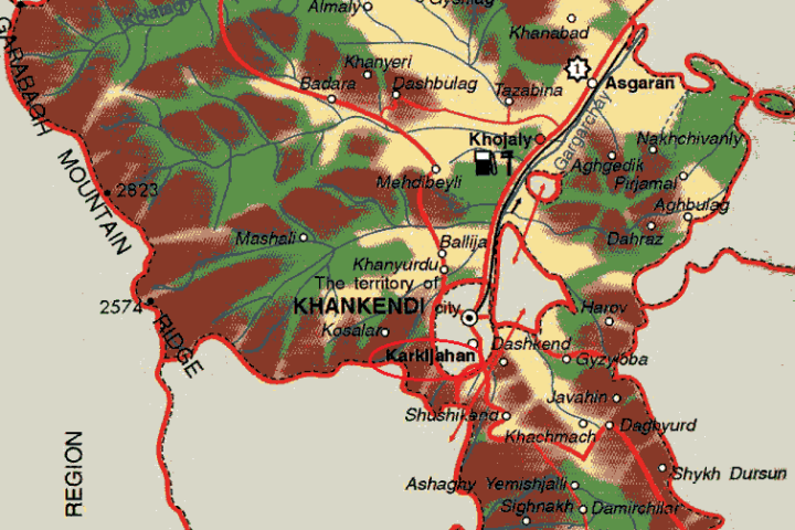
The region covers the following districts and villages: city of Lachin; district of Gayghi and villages оf Agbulag; Alkhasly; Ahmadli; Hajilar; Gulabird; Jagazur; Gushchu; Minkend; Mirik; Mishni; Sadynlar; Sheylanly Agjakend; Ardushlu; Agjayazy; Ashaghi Farajan; Farajan; Bozlu; Galaja; Bulunduz; Ayibazar; Birinji Ipek; Vagazin; Bozguney; Kalafalyg; Hajikhanly; Govushug; Budagdere; Hojaz; Mollalar; Uluduz; Avazlar; Dashly; Valibayli; Naryshlar; Hetemler; Kaha; Jijimli; Ashaghi Jijimli; Gazydere; Zabukh; Sus; Ghyzylja; Baylik; Irchan; Chambarakhach; Khumarta; Garabayli; Lolabaghirli; Korchabulag; Zerti; Khyrmanlar; Agbulag; Birinji Tyghyk; Ikinji Tyghyk; Garygyshlag; Soyugbulag; Ghylychly; Zeyve; Kohnekend; Gyshlag; Eyrek; Alyjan; Gozlu; Finghe; Gorchu; Zagalty; Goshasu; Alpout; Butovluk; Kurdhaji; Arikli; Hajisamly; Garasaggal; Kamally, Chyragly; Garakechdi; Katos; Malkhalaf; Mazutlu; Malikpeye; Malybay; Agoglan; Husulu; Ziyrik; Myghydere; Dayirmanyany; Tarkhanly; Dayhan; Baldyrganly; Oguldere; Agalarushaghy; Pirjahan; Seyidler; Garachanly; Pichenis; Khachynaly; Kohne Jorman; Sonasar; Mayis; Tezekend; Hagnezer; Erdeshevi; Safiyan; Khanalylar; Suarasy; Turkler; Farrash; Nureddin; Fatalipeye; Aganus; Unannovlu; Arab; Turshsu; Shelve; Imanlar; Dambulag; Shamkend; Elekchi; Bozdogan; Chorman; Nagdaly.
Socio-economic conclusions of the occupation
August 1993
| Territory | 1,835 sq. km |
| Families | 14,095 |
| Population | 61,763 (70,900 in 2011) |
| Killed | 324 persons |
| Handicapped | 1,125 persons |
| Orphaned | 1,200 persons |
Destruction and Losses
| Villages and settlements | 120 |
| Dwelling houses | 8,949 |
| Industrial and construction establishments | 7 |
| Service establishments | 471 |
| Schools | 154 |
| Health care centres | 30 |
| Cultural establishments | 360 |
| Farms | 40 |
Cultural monuments
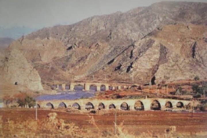
The region had the architectural monuments such as the Albanian temple (5th century), mausoleums (14th, 19th centuries), the fortress (17th century), the mosque (1718), the palace (1716), the bridge (18th century) and others.
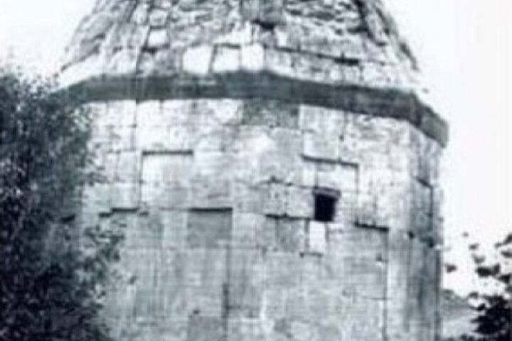
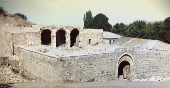
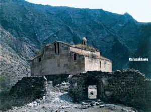
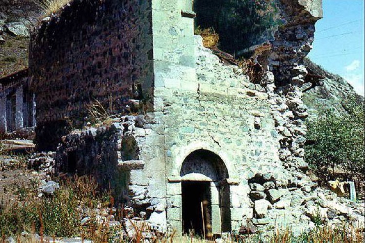
Agoglan Temple
Agoglan (Aghoghlan) temple is set in two acres of land at the 30th kilometer of Lachin-Minkend highway, on the right bank of the river Hekeri, near Kosalar village. Aghoghlan Temple is Albanian monastery built in the 5th-6th centuries. As the monument was exposed to avalanches and destructions at different times, it was rebuilt in the style of church and adapted to monastery. The first foundation of the monument was preserved in its initial form during repairs; the new walls were built over the old ones. After restoration, Aghoghlan temple had become one of the most spectacular monuments of the Albanian period architecture of the Azerbaijani history. The temple is 25 meters long and 12.5 meters wide. Two rows of the square-shaped eight bearing piles – pylons divided the inner side of the building into three parts.
The Agoglan Alban monastery (Lachin District) 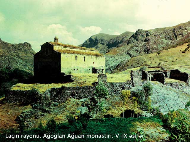
The Agoglan Alban monastery (Lachin District) 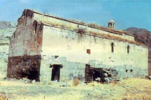
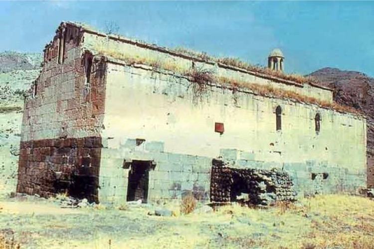
The monument has been under occupation since May 18, 1992. Armenians made illegal changes in architectural style and the interior of Aghoghlan monastery, completely wiped out the inscriptions on the walls of the monument, as well as a large number of ornaments and symbols reflecting the Albanian period or greatly changed them. In 2006, under the pretext of repairing the monument for the second time, the Armenians placed in different parts of the walls 26 boards with inscriptions indicating belongingness of the monument to the Armenian Apostolic Church. 2 tombstones were erected in the right side of the courtyard and 2 stone crosses made of red basalt stone from Yerevan were erected in front of the entrance door by Armenians.
After the occupation the Armenians renamed the Aghoghlan temple “Jijernavank”.
Hamza Soltan Palace
Hamza Soltan Palace, Lachin, 1761
The palace is situated in Husulu village of Lachin region. The Hamza Soltan Palace is supposed to be built in 1761. From the general view of the palace it becomes clear that, the castle had a tall tower. There was an entrance door in the corner of the south side of the castle. The two-storeyed palace has beautiful arched ceilings fastened to the thick side walls. The palace also has a large hall, a number of auxiliary rooms and a court-house. Delicately embellished door and windows of the palace are made of the walnut wood. Eastern architectural traditions were widely used in the building of the palace. Most probably the sultanate was established here in 1700 and governed a large part of Zangezur region. The palace building was constructed of local stone and construction lime.
After the occupation by Armenia, the village was renamed Melikatun. During the occupation, the Armenian invaders make use of the repaired Hamza Soltan Palace as a guest house or a hotel for tourists.
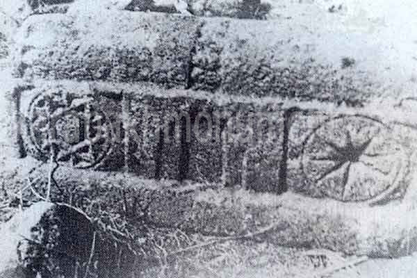
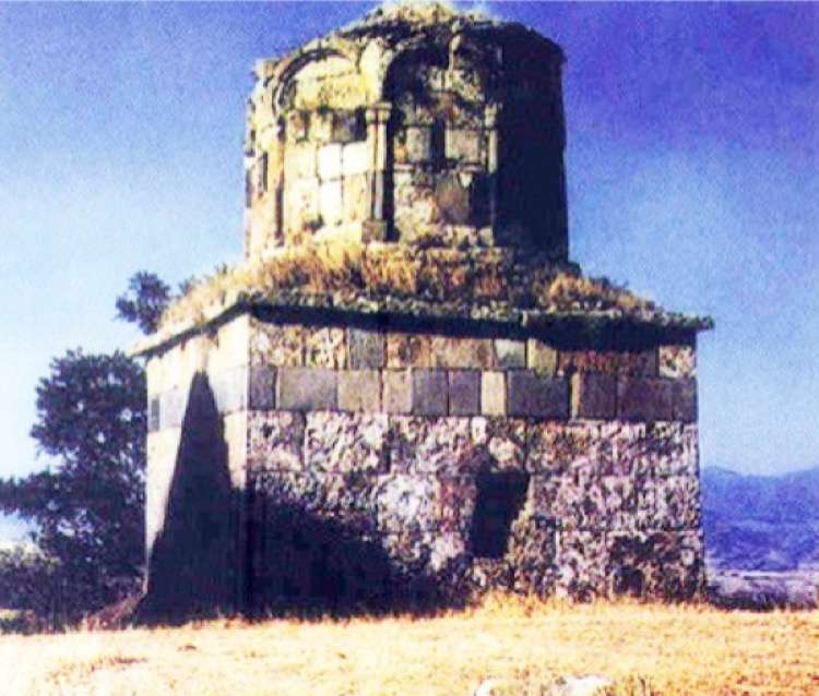
Jijimli Village Tombs
Two tombs rise close within a shrine near Jijimli village – the mausoleum of Malik Ajdar and the mausoleum Kargumbez. Malik Ajdar Tomb, traditionally considered the oldest one, is circular inside and octagonal outside.
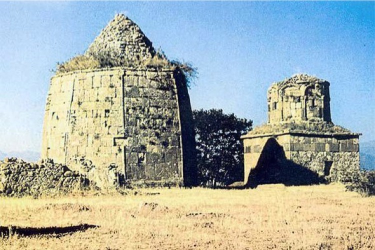

The right-angle opening of the tomb, the front door is in the northern side. The top of the door frame is covered with a pointed-beam-like architrave stone. Inside its edge, remains of a rider’s hewn picture are observed. A number of the site’s details are the same as those of tombs in Damirchilar village of Gubadli region. There are no construction inscriptions and carved surfaces on the tombs. The researchers supposedly date the Jijimli tomb from the 12th-13th centuries. The late 13th century, in the reign of Elkhanids, seems more convincing as the construction time.
Popularly called the “Deaf Dome”, the other Jijimli tomb is cruciform inside and square outside. It is supposed to have been constructed in the 17th century.
According the legend the tombs were constructed by a teacher and his apprentice. The tomb of the apprentice was better and the teacher damned it. So it was called Kargumbez – “a deaf dome” and there is no echo in this tomb.